STING COPPER PROJECT
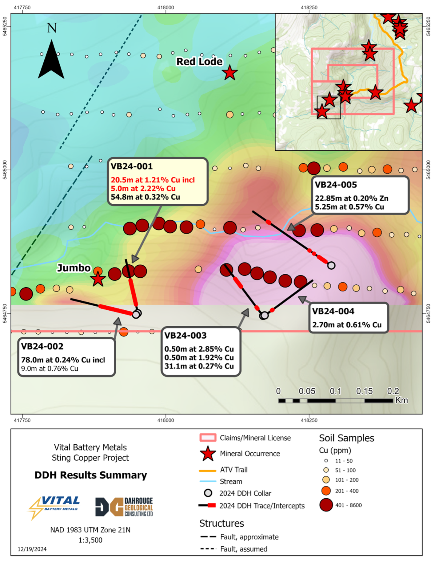
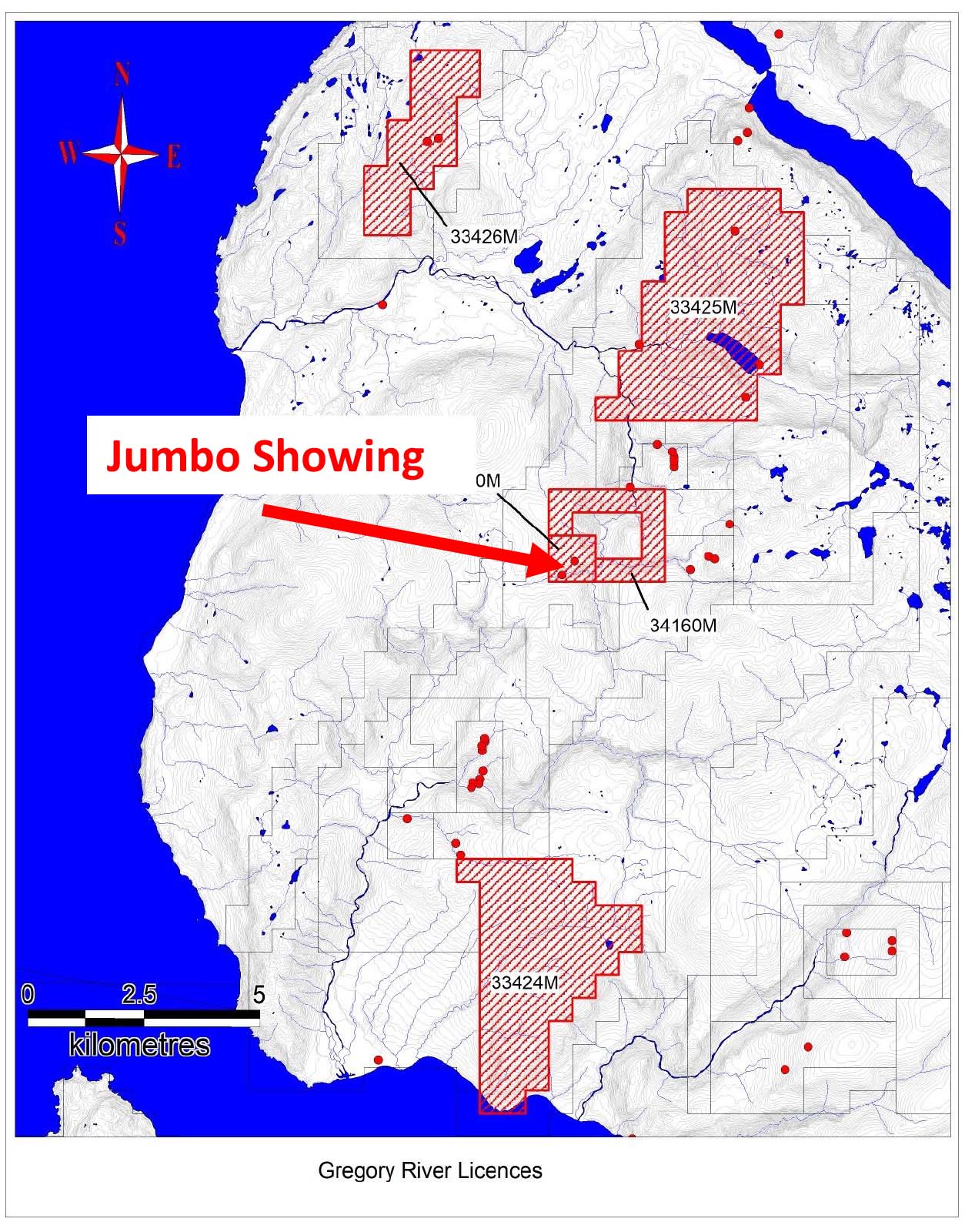
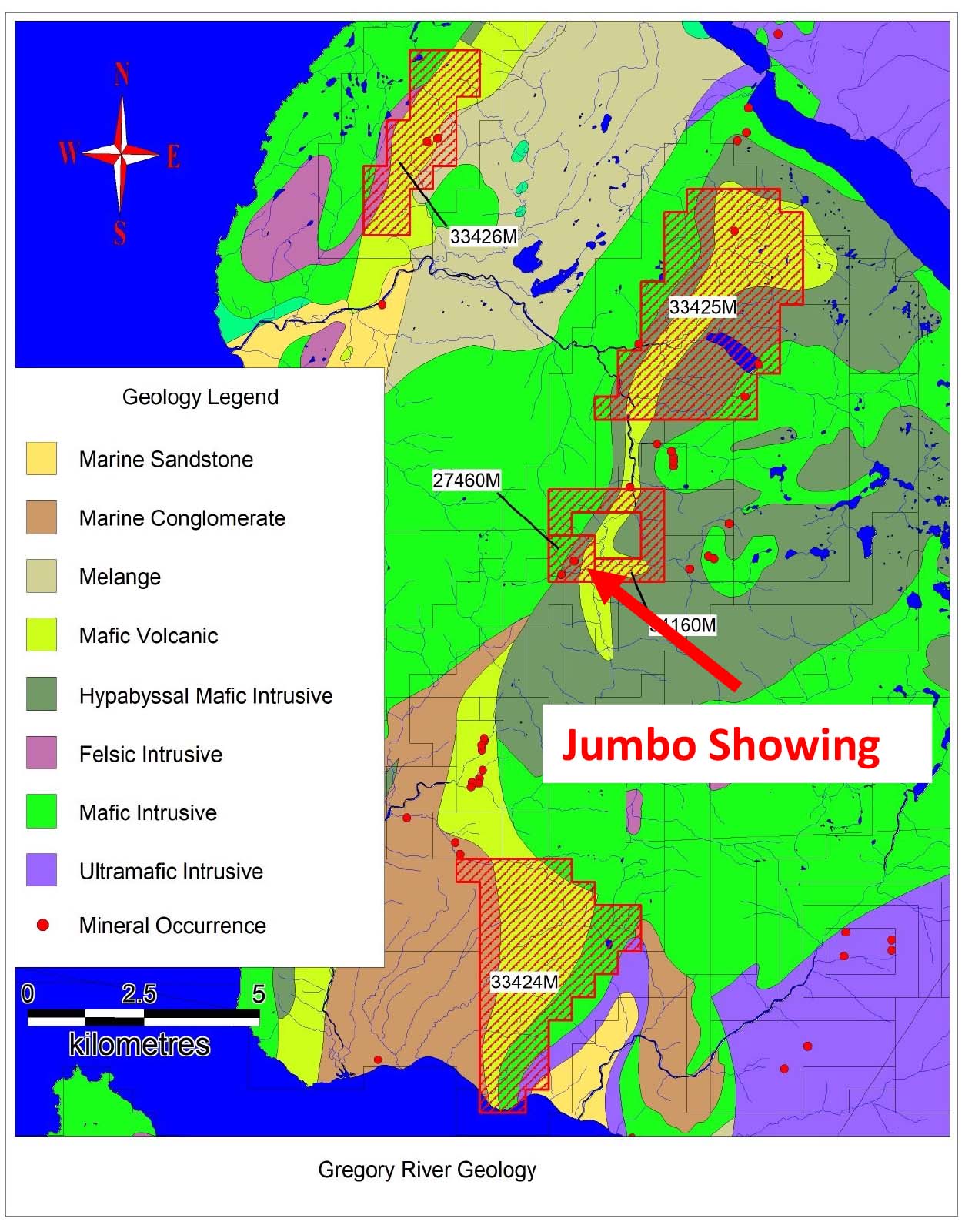
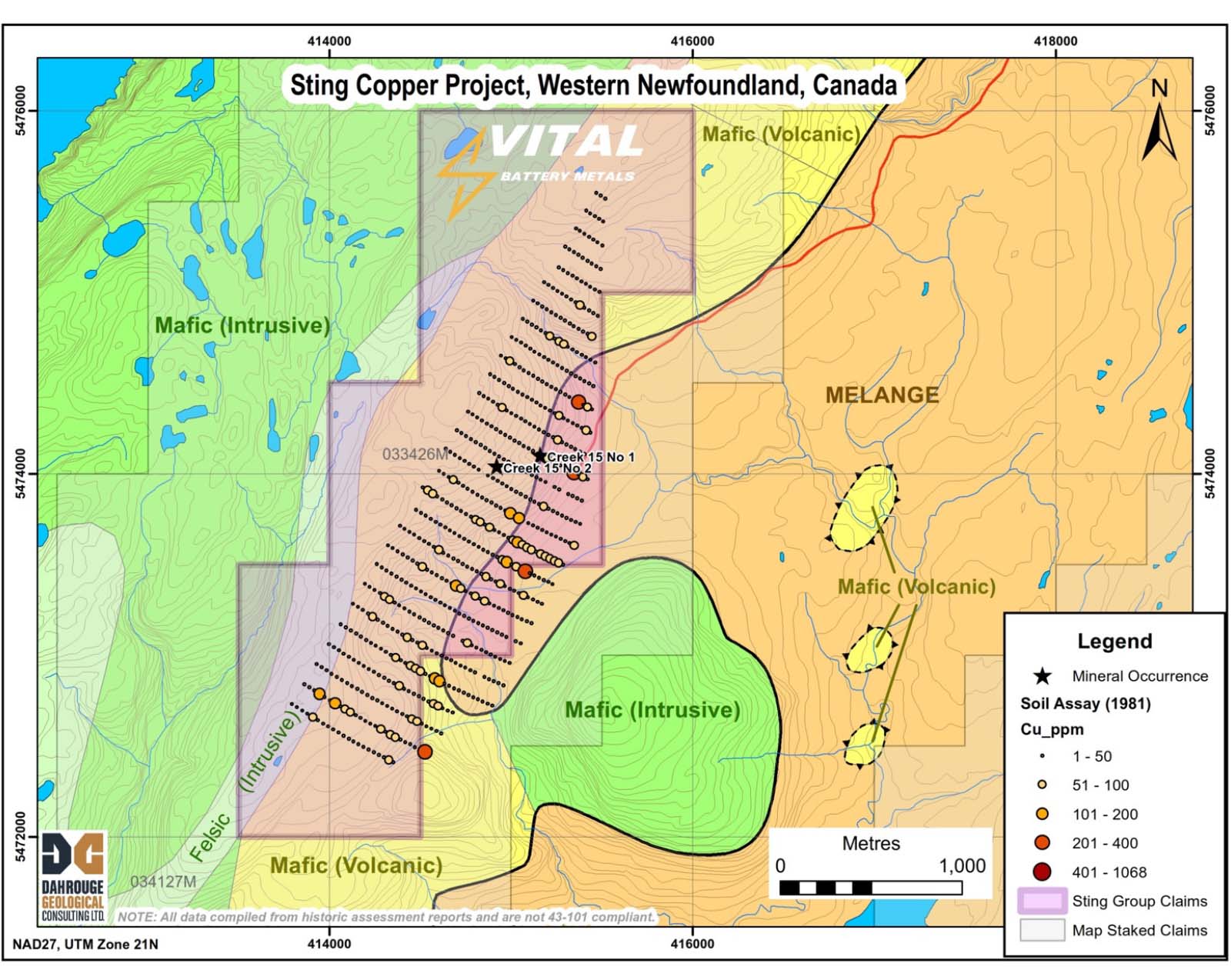
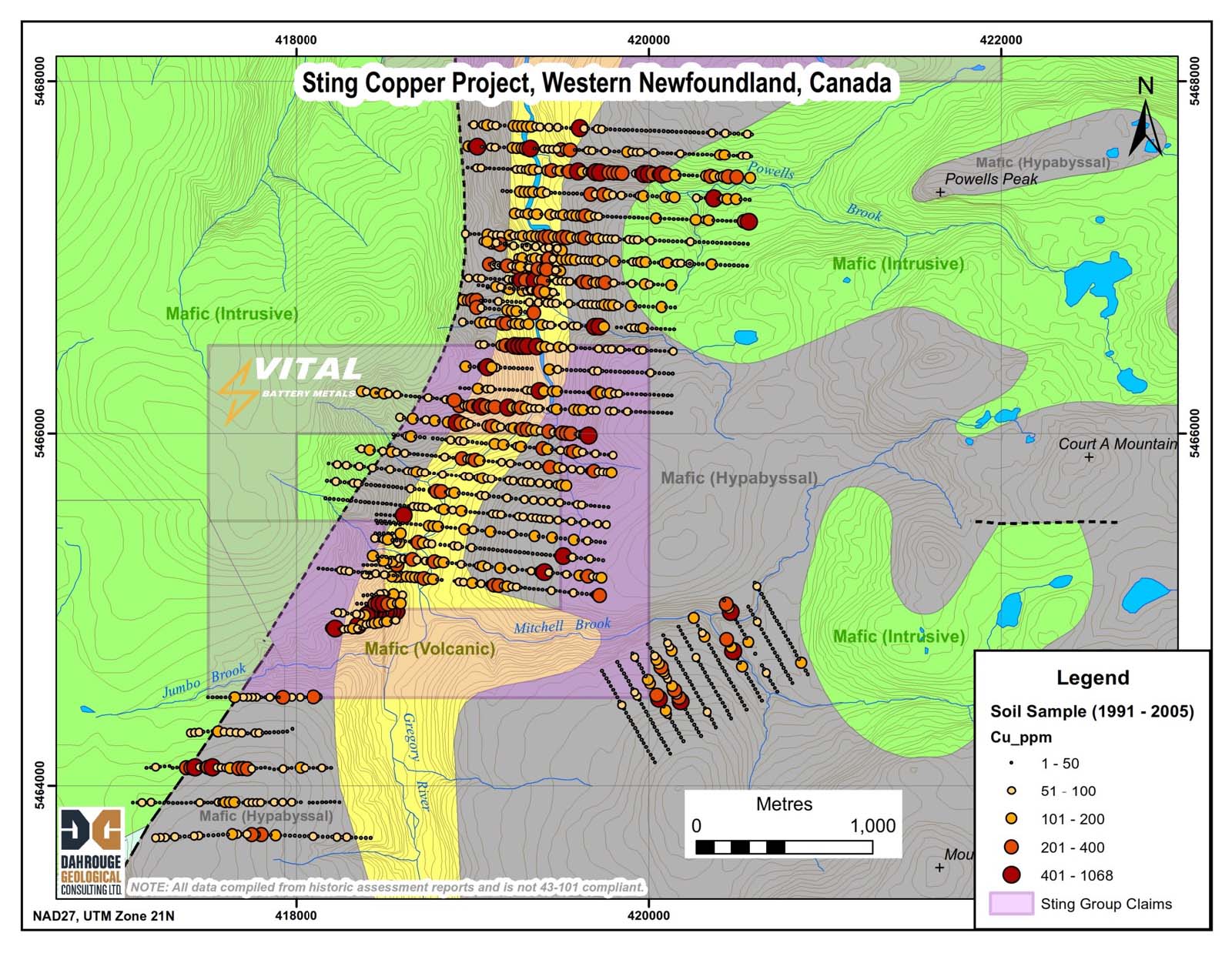
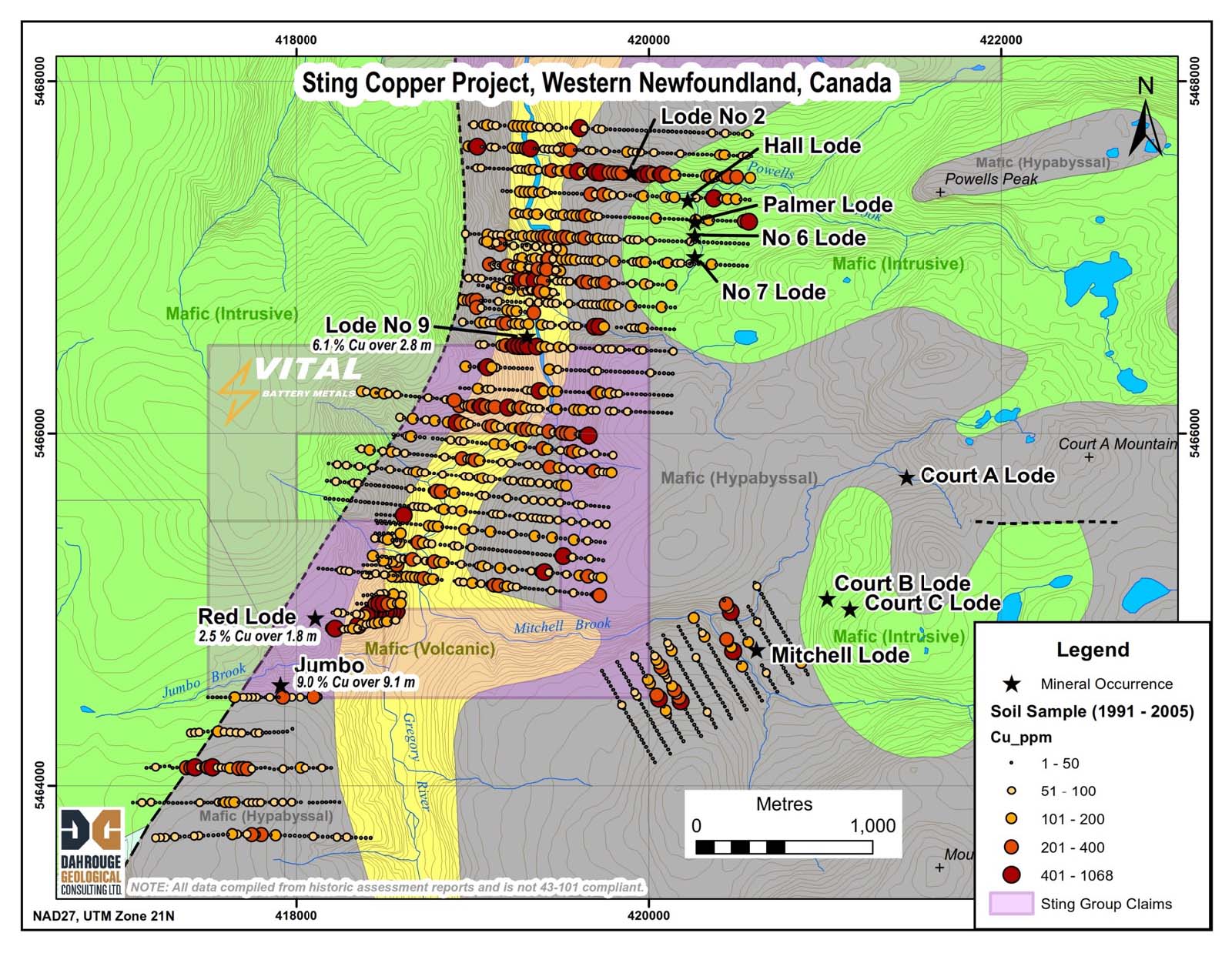
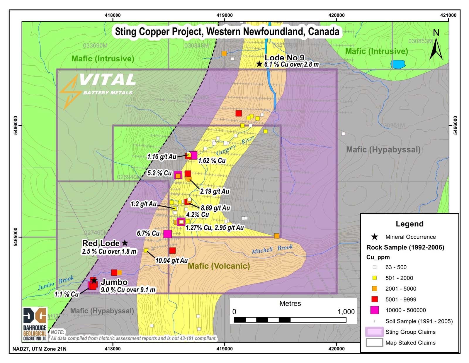
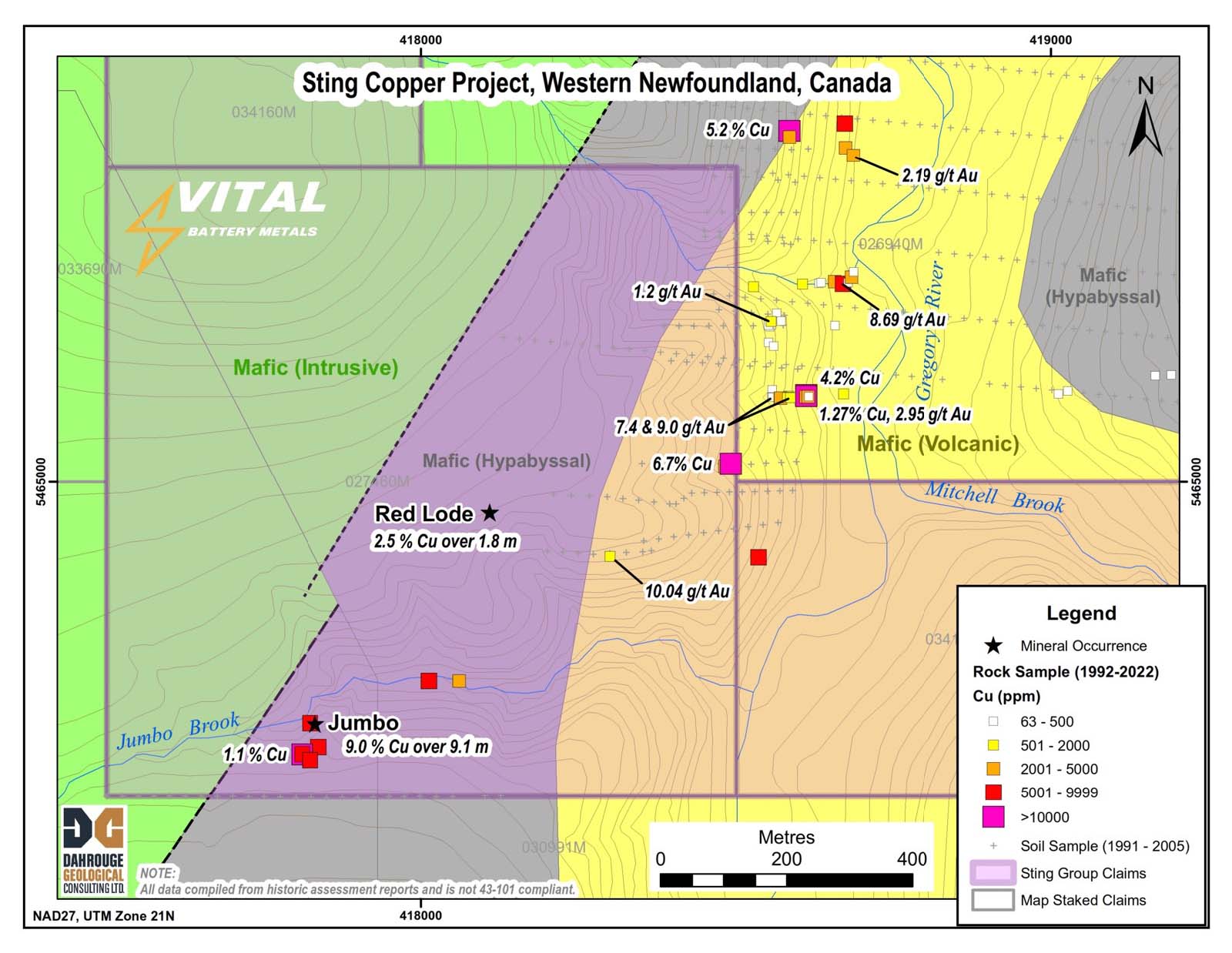
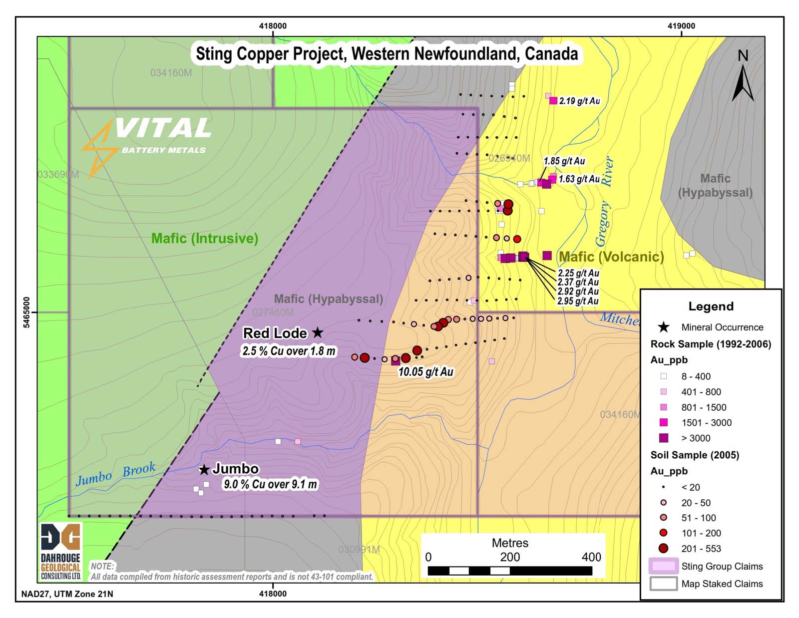
Initial drilling targeted the Jumbo showing, previously reported
as 9.0% Cu across 9.1m (Assessment File 012G/08/0002).
Key results include:
These results demonstrate the potential of the Sting Copper Project to host significant copper and zinc mineralization. The discovery of high-grade zones alongside broader lower-grade intervals may provide vectors for additional zones of interest.
Table 1: Detailed information for drill holes outlined
Hole ID | UTM Coordinates (NAD 83) | Azimuth (°) | Dip (°) | Length (m) | ||
Easting | Northing | Elevation | ||||
VB24-001 | 417951 | 5464750 | 386 | 347 | -55 | 159 |
VB24-002 | 417948 | 5464747 | 385 | 284 | -46 | 162 |
VB24-003 | 418169 | 5464745 | 379 | 324 | -56 | 192 |
VB24-004 | 418172 | 5464746 | 377 | 54 | -47 | 147 |
VB24-005 | 418288 | 5464833 | 360 | 323 | -50 | 252 |
Table 2: Summary of analytical results in Sting fall 2024 drill program
Hole ID |
| From (m) | To (m) | Interval (m) | Cu (%) | Zn (%) |
VB24-001 |
| 27.00 | 81.80 | 54.80 | 0.32 | 0.01 |
incl. | 71.20 | 71.80 | 0.60 | 5.43 | 0.07 | |
| 81.80 | 102.25 | 20.45 | 1.21 | 0.02 | |
incl. | 81.80 | 86.80 | 5.00 | 2.22 | 0.03 | |
or | 81.80 | 82.30 | 0.50 | 6.84 | 0.05 | |
or | 85.70 | 86.20 | 0.50 | 7.12 | 0.08 | |
| ||||||
VB24-002 |
| 13.50 | 91.50 | 78.00 | 0.24 | 0.01 |
incl. | 22.00 | 31.00 | 9.00 | 0.76 | 0.02 | |
or | 25.70 | 26.30 | 0.60 | 5.23 | 0.08 | |
| ||||||
VB24-003 |
| 28.60 | 29.10 | 0.50 | 2.85 | 0.08 |
| 33.25 | 33.75 | 0.50 | 1.92 | 0.13 | |
| 113.90 | 145.00 | 31.10 | 0.27 | 0.02 | |
incl. | 113.90 | 114.40 | 0.50 | 1.99 | 0.03 | |
incl. | 120.10 | 120.75 | 0.65 | 1.56 | 0.03 | |
incl. | 124.10 | 124.70 | 0.60 | 2.02 | 0.03 | |
| ||||||
VB24-004 |
| 22.00 | 24.70 | 2.70 | 0.61 | 0.04 |
| ||||||
VB24-005 |
| 18.30 | 41.15 | 22.85 | 0.04 | 0.2 |
incl. | 34.00 | 37.50 | 3.50 | 0.10 | 0.51 | |
| 56.50 | 57.00 | 0.50 | 1.24 | 0.60 | |
| 70.95 | 72.00 | 1.05 | 1.13 | 0.12 | |
| 204.00 | 209.25 | 5.25 | 0.57 | 0.02 |
Note: All results upon which this table was based were above the analytical detection limit. No grade cutoffs were used for grade width calculations.
*Cautionary Note: Contact angles of sulphide mineralization and quartz veining suggest the true thicknesses of mineralized intercepts in VB24-001 may be ~25-50% of the original drilled thickness. Intercepts in VB24-003 and VB24-005 are believed to be close to the true thickness, while orientations in VB24-002 and VB24-004 could not be determined with confidence.
Zone 2: Red Lode Deposit
Zone 3: Lode #9 Prospect
The sulphide-bearing vein which outcrops on the west bank of the Gregory River and close to the intrusive contact of gabbros and metavolcanic rocks occupies a brecciated zone in which the country rocks are cemented largely by quartz.
Assay results for channel samples were reported by Hatch (1922) as 1.63% Cu/0.3 m; 1.88% Cu/0.6 m; 6.17% Cu/1.37 m; 1.07% Cu/0.7 m and 11.4% Cu/0.68 m.
Zone 4: Chimney Cove Brook
Structurally, the area lies within a tight, gently plunging syncline, the axis of which trends through the Gregory River. The north-south trending Gregory River Fault transects the region. This major fault and associated minor faults and shearing appear to be the focus of mineralization. The mineralization occurs either massive or disseminated.
Zone 5: Chimney Cove Pond East
Harrison and Lilly (1955) reported a chalcopyrite occurrence at Chimney Cove Pond on a regional geology map. The occurrence is hosted within bytownite gabbro, anorthosite, clinopyroxenite and troctolite of the Lower Ordovician Bay of Islands Complex.
Zone 6: Creek 15 No. 2
The Humber Arm Allochthon is 200 km long and about 50 km across at its widest part. Its structural thickness is in the order of a few kilometres. Sedimentary rocks of lower structural slices of the Humber Arm Allochthon are assigned to the Humber Arm Supergroup.
A soil survey (Duval International Corp., 1981) outlined anomalous copper up to 225 ppm in soil near the contact of mafic volcanic rocks with felsic volcanics. Mineralization was located at the Creek 15 occurrence and is described as disseminated to stringer zinc copper sulfide in altered felsic volcanic rocks. Duval report values of up to 2.38% Cu over 3.1m from altered and brecciated rhyolite flows and agglomerate.
A detailed view of the Jumbo Lode / Red Lode area shows soil sample results from work reports filed between 1992 and 2005. The results define strongly anomalous copper in soil located east of the known showings and suggests mineralization occurs in this area within the adjacent mafic volcanic rocks. The soil anomaly is open to the south.
Ontario
Ontario
Enter your details in the form to sign up for our News Alerts.