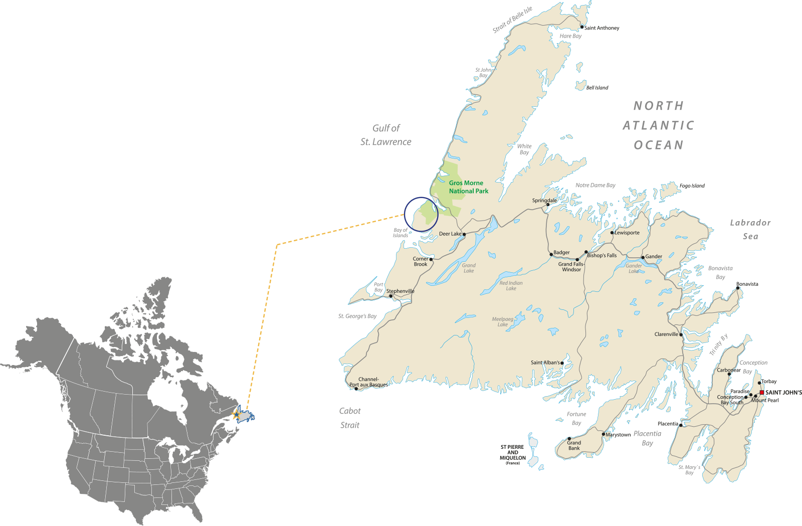
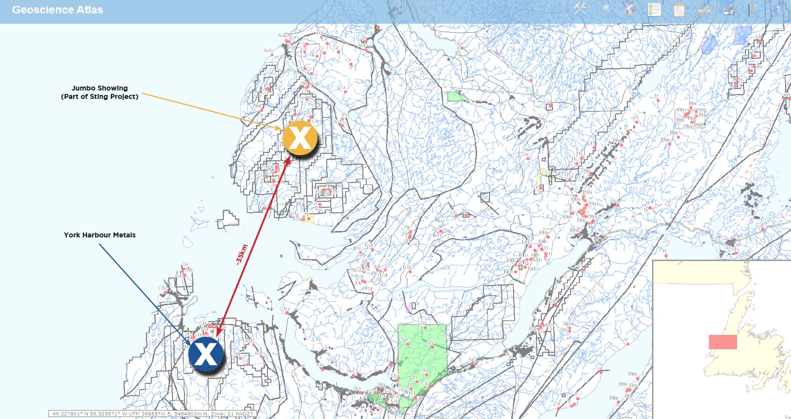
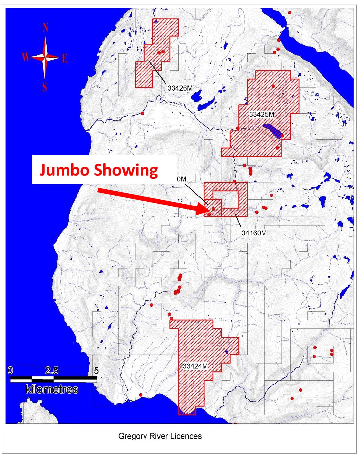
~35 km NE of York Harbour Metals Inc. (TSXV: YORK) ~$80M market cap.
Over 10 government documented Mineral occurrences on property.
The Jumbo occurrence is the most significant with channel samples assaying 14% Cu over3 meters and 9.3% Cu over 10 meters.
Click image to enlarge.
Zone 1: Jumbo Deposit
The Jumbo Lode is located along the south bank of Jumbo Brook. The settlement of Trout River is located 14 km north of the area. Access is by muskeg trail from Trout River or by helicopter from Deer Lake.
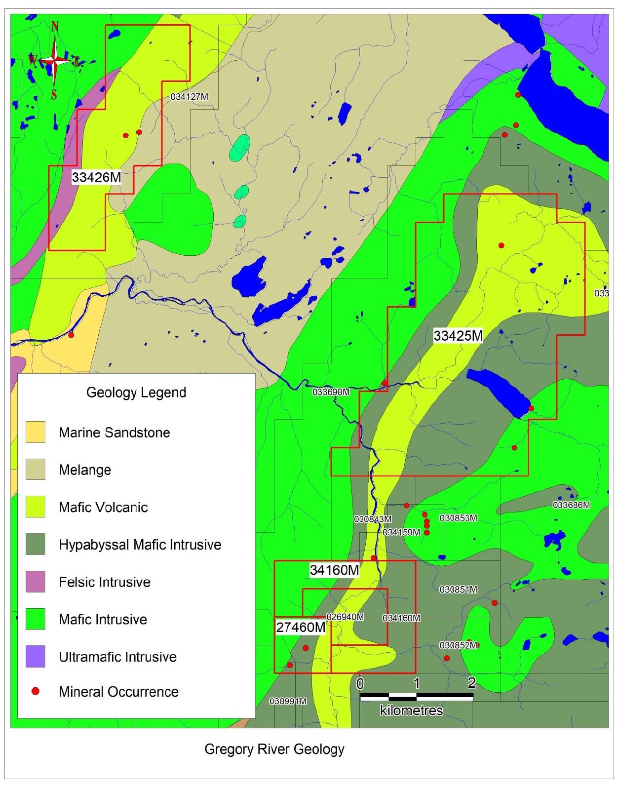
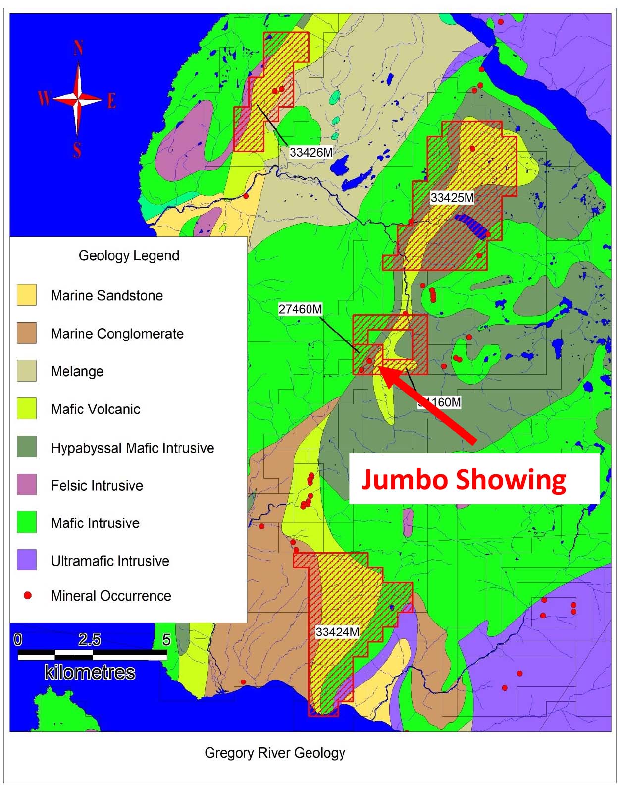
The occurrence is hosted within gabbroic and/or sheet, mafic dykes of the allochthonous Bay of Islands ophiolite complex. Copper mineralization occurs either massive or disseminated.
The ore is localized near the Gregory River fault which forms a highly sheared contact between the gabbro and basic volcanics. Newfoundland government data indicates 17 drill holes and trenching on-site on the adjacent Mitch Copper Prospects.
Channel samples assayed 14% Cu over 3.0 m and 9.3% Cu over 10.0 m. Grab samples assayed 6.4% Cu from the basal 0.3 m of lode and 0.13% Cu from the upper 1.5 m of the lode. Dean (1978) estimated grade and tonnage of high-grade ore as 14.7% Cu and 13,400 tonnes and disseminated ore as 6.0% Cu and 25,000 tonnes.
Jumbo Lode was first trenched and sampled in 1922 by Reid Nfld. Co. Ltd. Cape Copper Mines trenched and dug two adits between 1953 and 1954.
In 1970, Noranda mapped, soil sampled, and conducted Mag., S.P., and JEM (shoot back) surveys. During the following year Derry, Michener and Booth conducted sampling throughout the area.
In 1979-80, minimal sampling was done by a number of companies including Chevron Minerals, Teck Corporation, RioCan, Placer Development, Utah Mines Ltd. and Noranda Exploration Co. Ltd.
Click image to enlarge.
ADDITIONAL ZONES
ADDITIONAL ZONES
Zone 2: Red Lode Deposit
The occurrence is located on a tributary just north of Jumbo Brook. Copper mineralization occurs hosted within light to dark green, medium to coarse grained gabbro of the lower Ordovician Bay of Islands ophiolite complex.
Extensive work is reported on adjancent Copper occurances.
Norseman Corp. Ltd. optioned the properties from Mines and Forests Nfld. Ltd. in 1929. It was recommended that tunnels be driven in Hall, Palmer, #6, #7, Mitchell and #9 lodes. Prior to 1939, two adits were driven on Jumbo Lode. In 1951-54 Cape Copper Mines Ltd. drilled 17 holes totalling 1490 m on Mitchell Lode and in 1953-54 the Newfoundland Government drilled Court A and B. Copper was intersected but no assays are recorded in drill logs.
Zone 3: Lode #9 Prospect
The sulphide-bearing vein which outcrops on the west bank of the Gregory River and close to the intrusive contact of gabbros and metavolcanic rocks occupies a brecciated zone in which the country rocks are cemented largely by quartz.
Assay results for channel samples were reported by Hatch (1922) as 1.63% Cu/0.3 m; 1.88% Cu/0.6 m; 6.17% Cu/1.37 m; 1.07% Cu/0.7 m and 11.4% Cu/0.68 m.
Click image to enlarge.
Click image to enlarge.
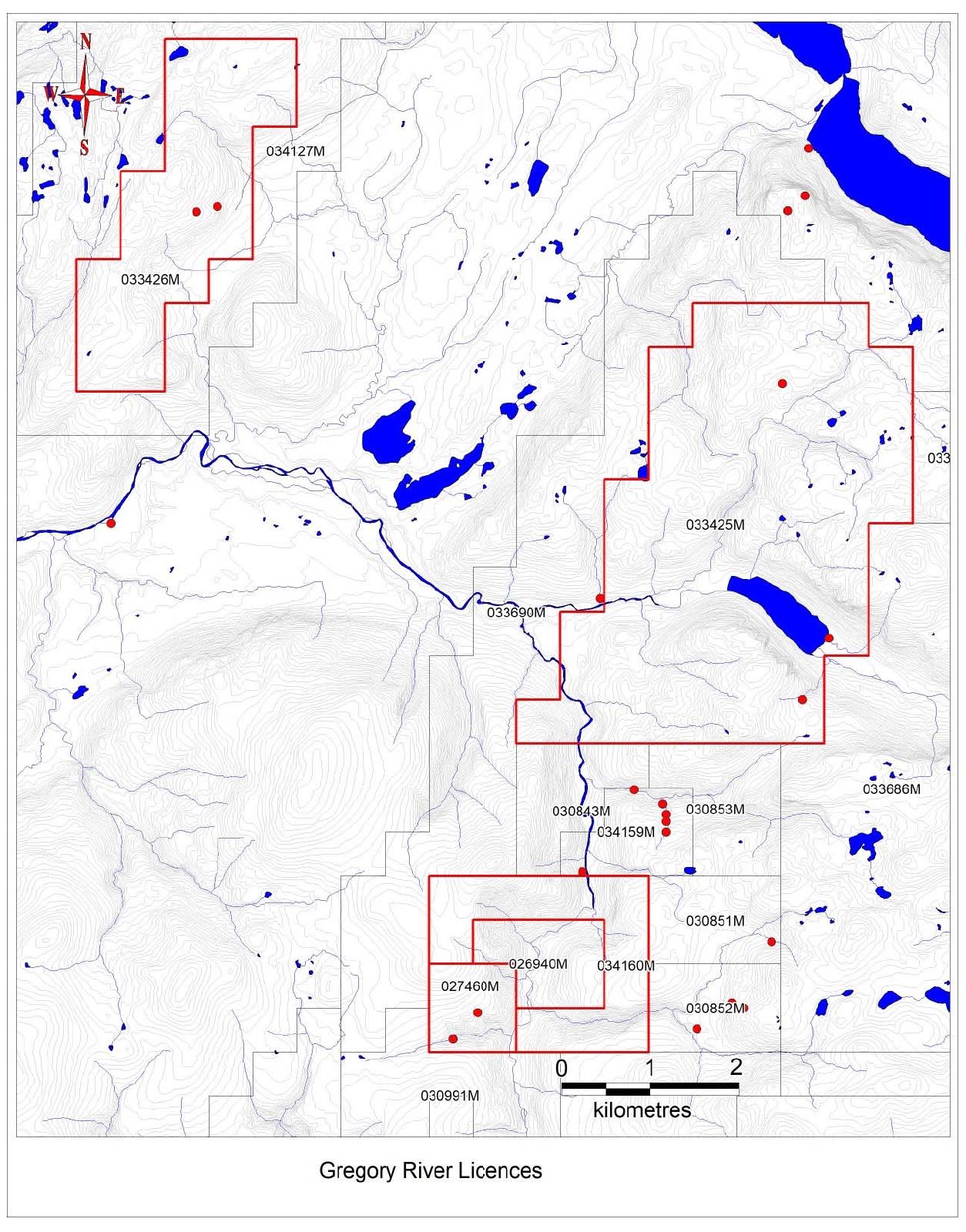
Sting Licenses (Red). Click image to enlarge.
Sting Licenses (Red). Click image to enlarge.
Zone 4: Chimney Cove Brook
Structurally, the area lies within a tight, gently plunging syncline, the axis of which trends through the Gregory River. The north-south trending Gregory River Fault transects the region. This major fault and associated minor faults and shearing appear to be the focus of mineralization. The mineralization occurs either massive or disseminated.
Zone 5: Chimney Cove Pond East
Harrison and Lilly (1955) reported a chalcopyrite occurrence at Chimney Cove Pond on a regional geology map. The occurrence is hosted within bytownite gabbro, anorthosite, clinopyroxenite and troctolite of the Lower Ordovician Bay of Islands Complex.
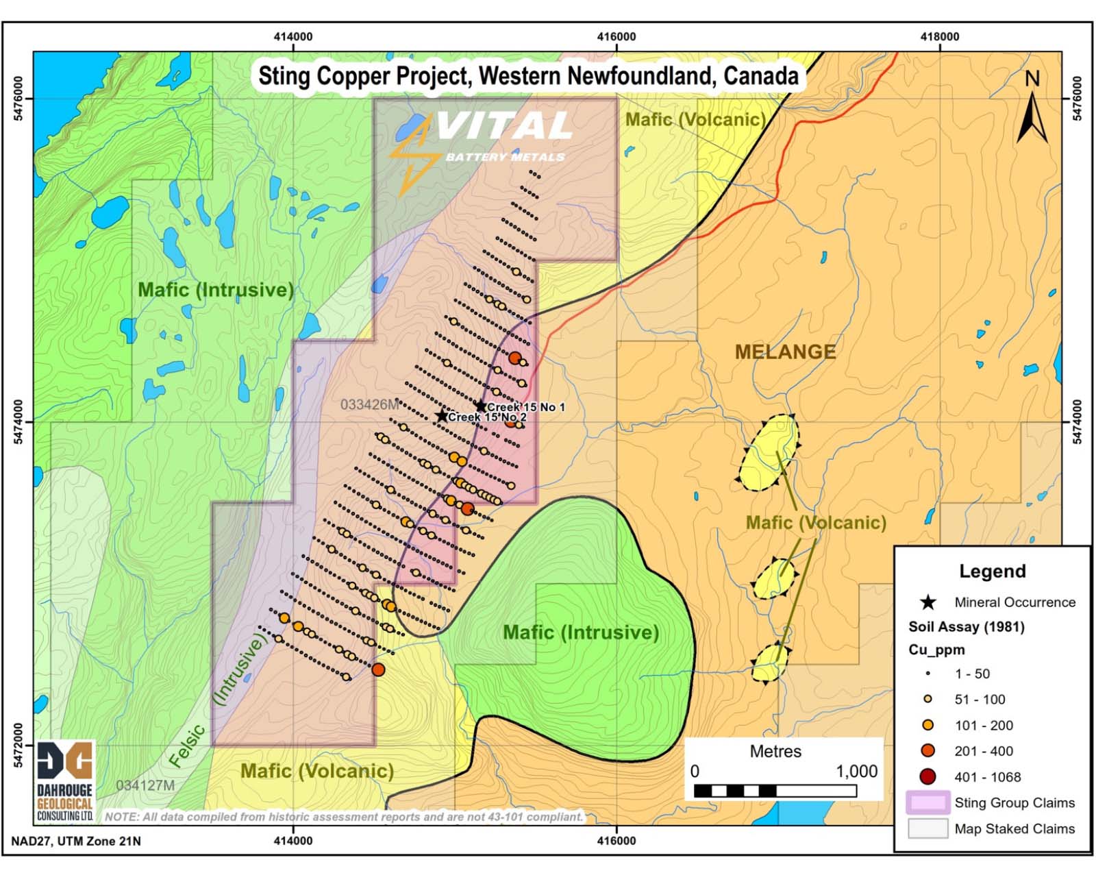
Zone 6: Creek 15 No. 2
The Humber Arm Allochthon is 200 km long and about 50 km across at its widest part. Its structural thickness is in the order of a few kilometres. Sedimentary rocks of lower structural slices of the Humber Arm Allochthon are assigned to the Humber Arm Supergroup.
Click image to enlarge.
A soil survey (Duval International Corp., 1981) outlined anomalous copper up to 225 ppm in soil near the contact of mafic volcanic rocks with felsic volcanics. Mineralization was located at the Creek 15 occurrence and is described as disseminated to stringer zinc copper sulfide in altered felsic volcanic rocks. Duval report values of up to 2.38% Cu over 3.1m from altered and brecciated rhyolite flows and agglomerate.
Click image to enlarge.
Later survey work by Noranda (1991) confirmed the mineralized zone and anomalous copper in soil. Noranda reported values from grab samples of 0.12% to 2.5% Cu, 0.23% to 1.87% Pb, 0.38% to 8.93 % Zn, 4.9g/t to 59 g/t Ag and 53 ppb to 780 ppb Au.
Click image to enlarge.
The combined grids show the extensive anomalous copper in soil in relation to the Creek 15 mineral occurrence.
Click image to enlarge.
Elevated nickel occurs throughout the grid area associated with the mafic rocks.
Click image to enlarge.
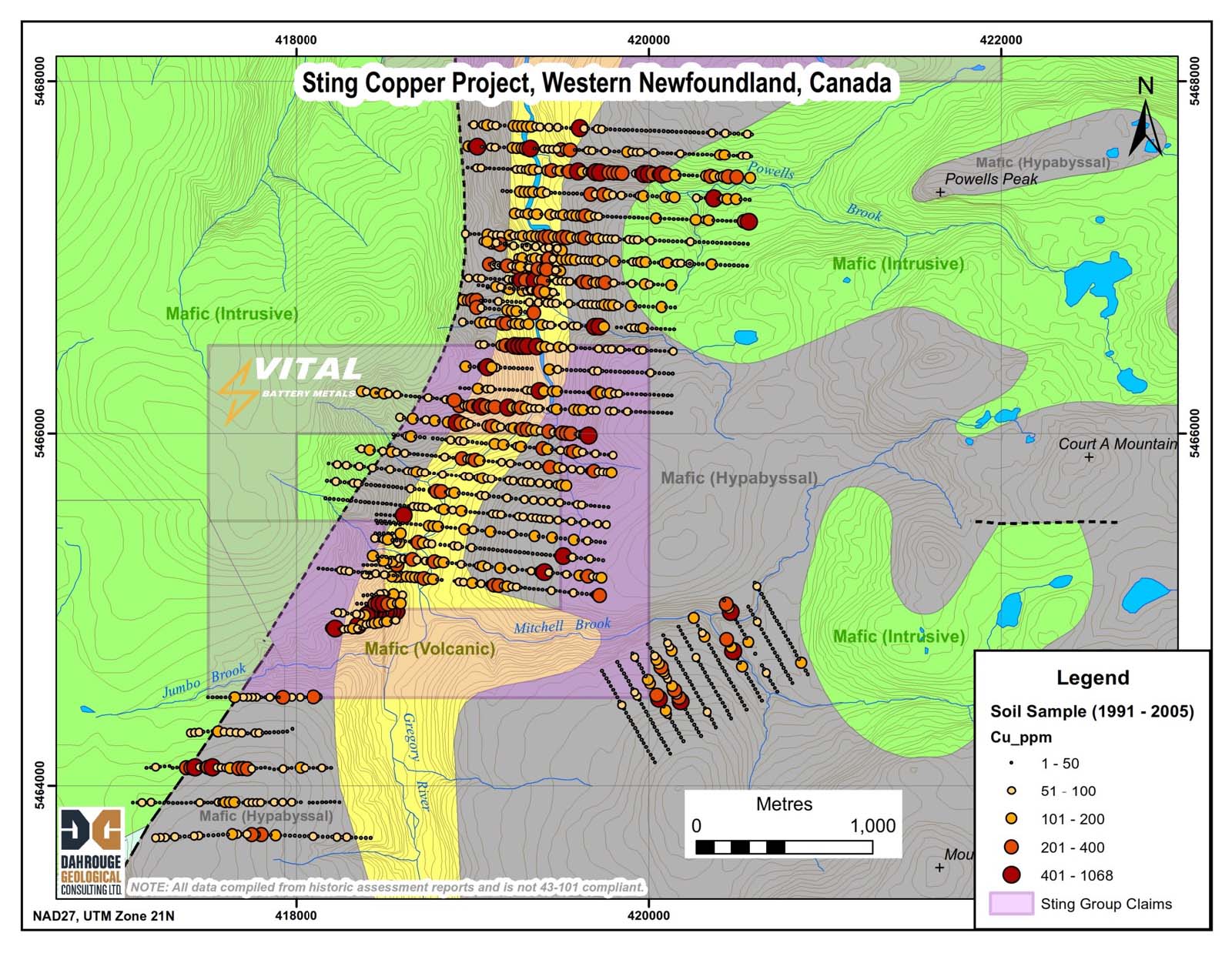
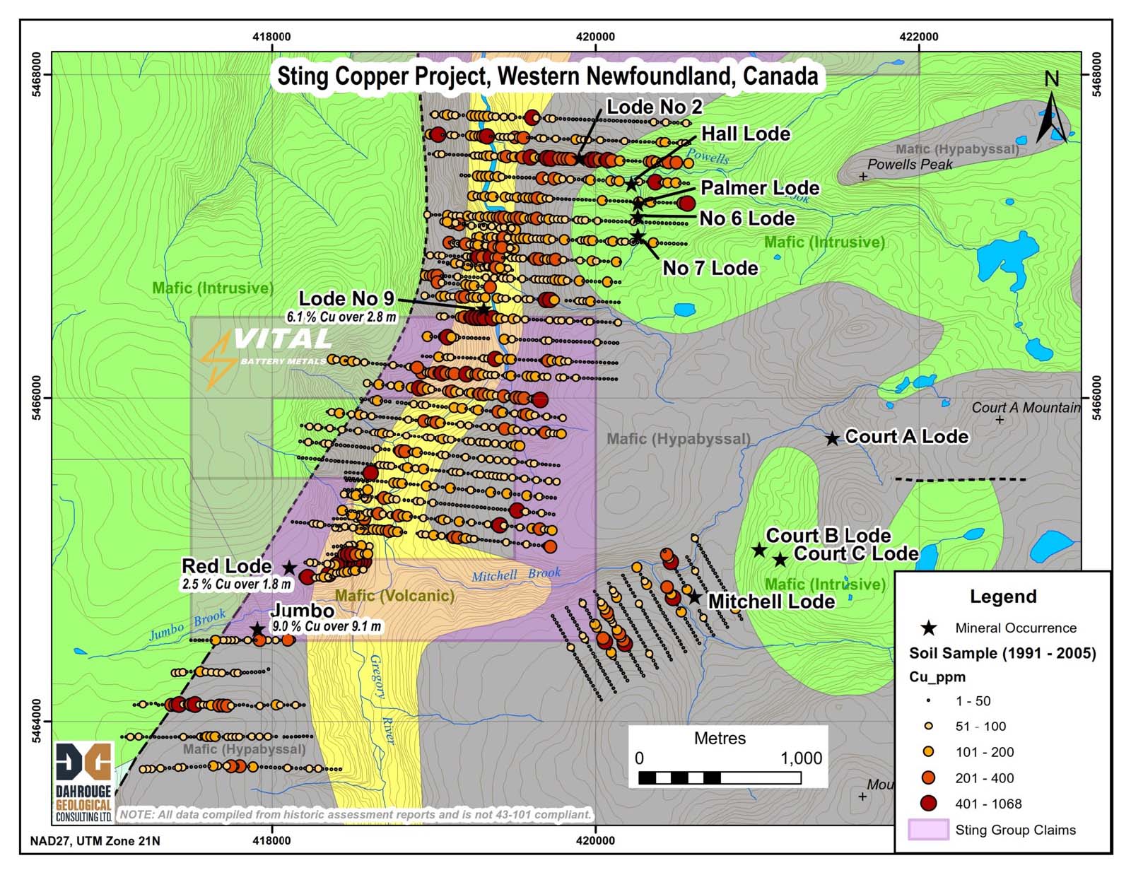
Multiple surveys carried out by exploration companies along Gregory River (work reports from 1991 to 2005) show strongly anomalous copper in soil associated with a basalt unit in contact with intrusive rocks.
Click image to enlarge.
The north-south trending basalt unit outcrops along Gregory River. Gabbro and sheeted dykes outcrop east and west of the basalt. Vein style high grade copper mineralization define mineral occurrences in the gabbro and basalt units spacially located near their contact.
Click image to enlarge.
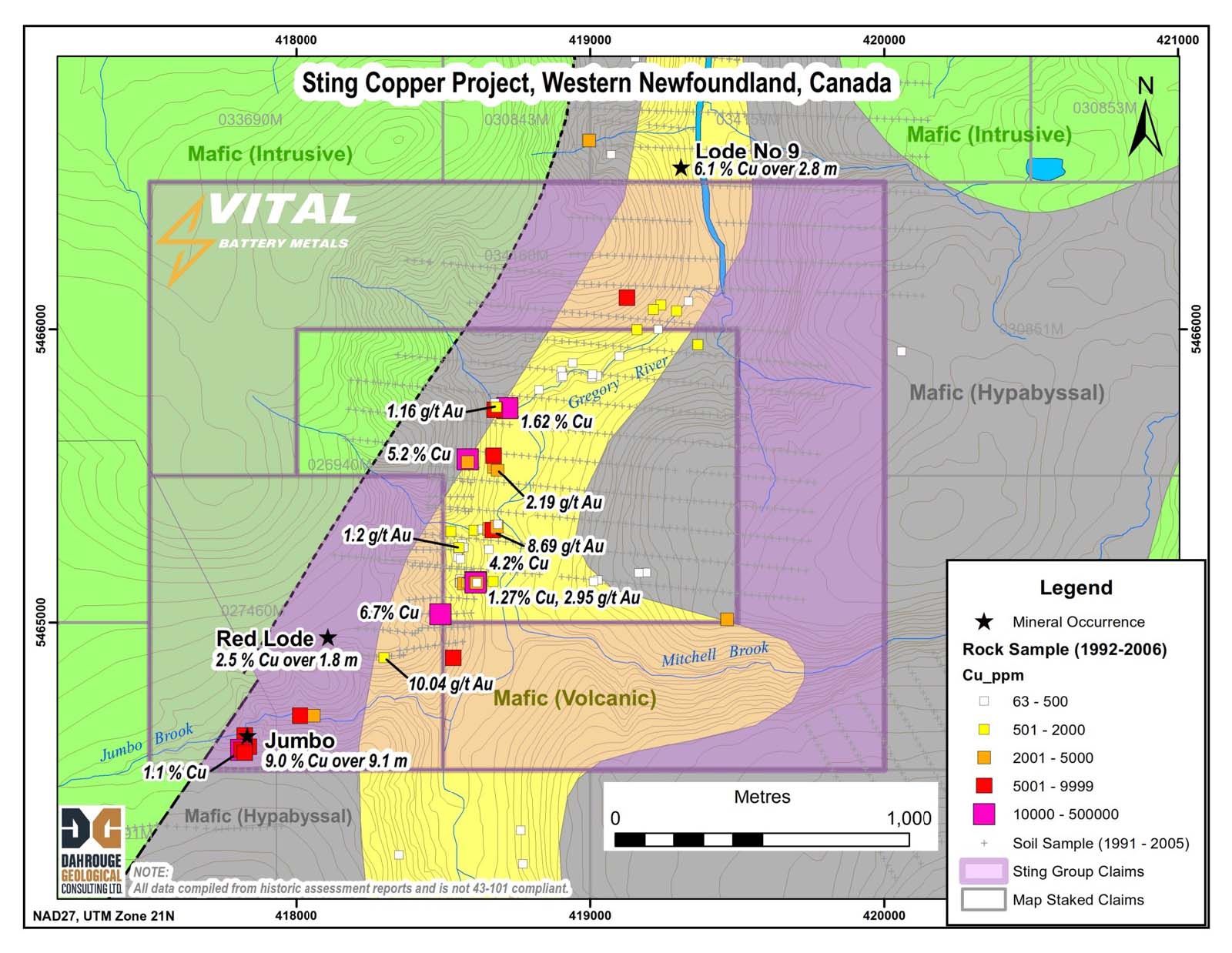
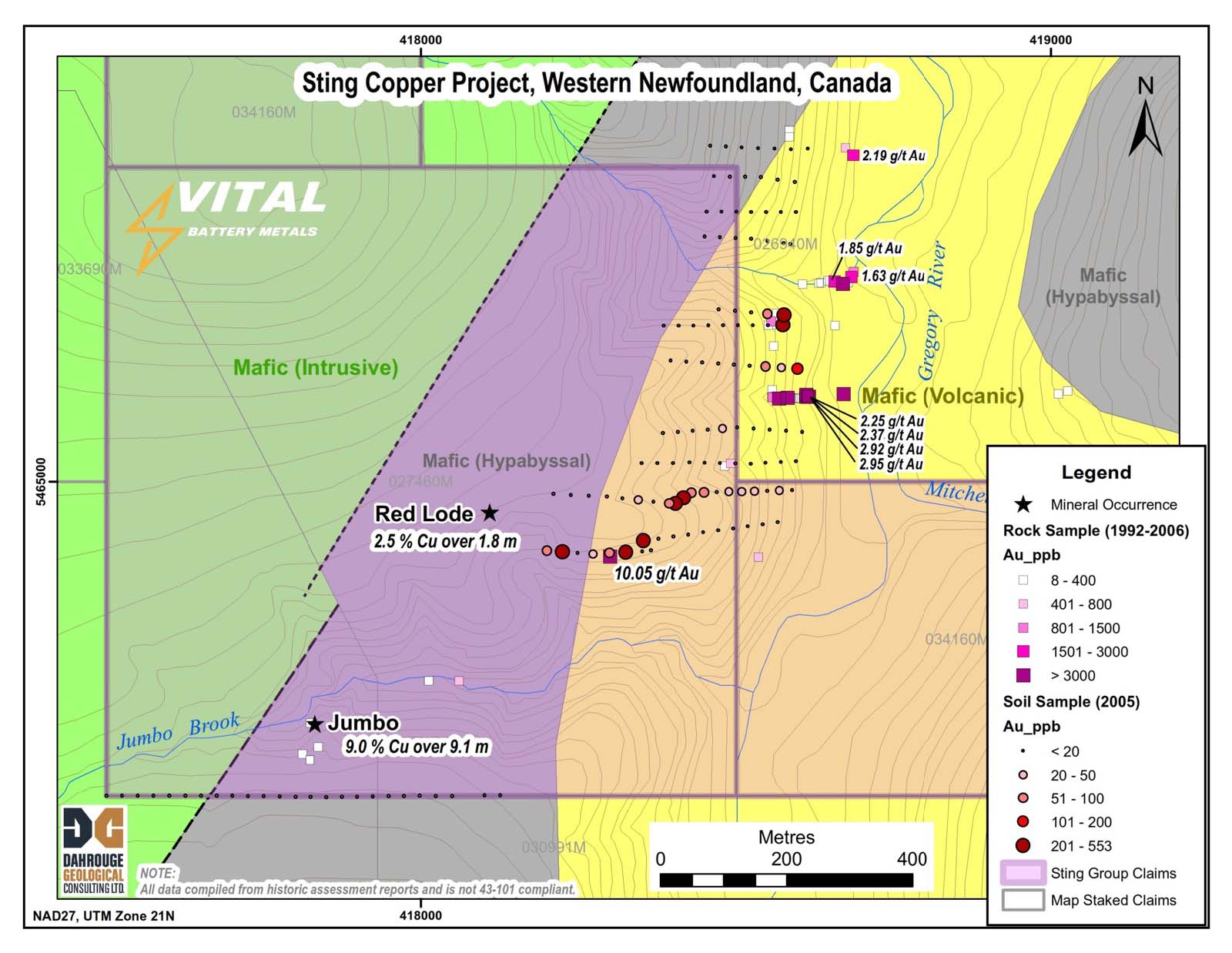
A detailed view of the Jumbo Lode area highlights rock samples collected by prospectors with assay values taken from reports of work submitted between 1992 and 2006. Results show very anomalous copper / gold values.
Click image to enlarge.
A detailed view of the Jumbo Lode / Red Lode area shows soil sample results from work reports filed between 1992 and 2005. The results define strongly anomalous copper in soil located east of the known showings and suggests mineralization occurs in this area within the adjacent mafic volcanic rocks. The soil anomaly is open to the south.
Click image to enlarge.
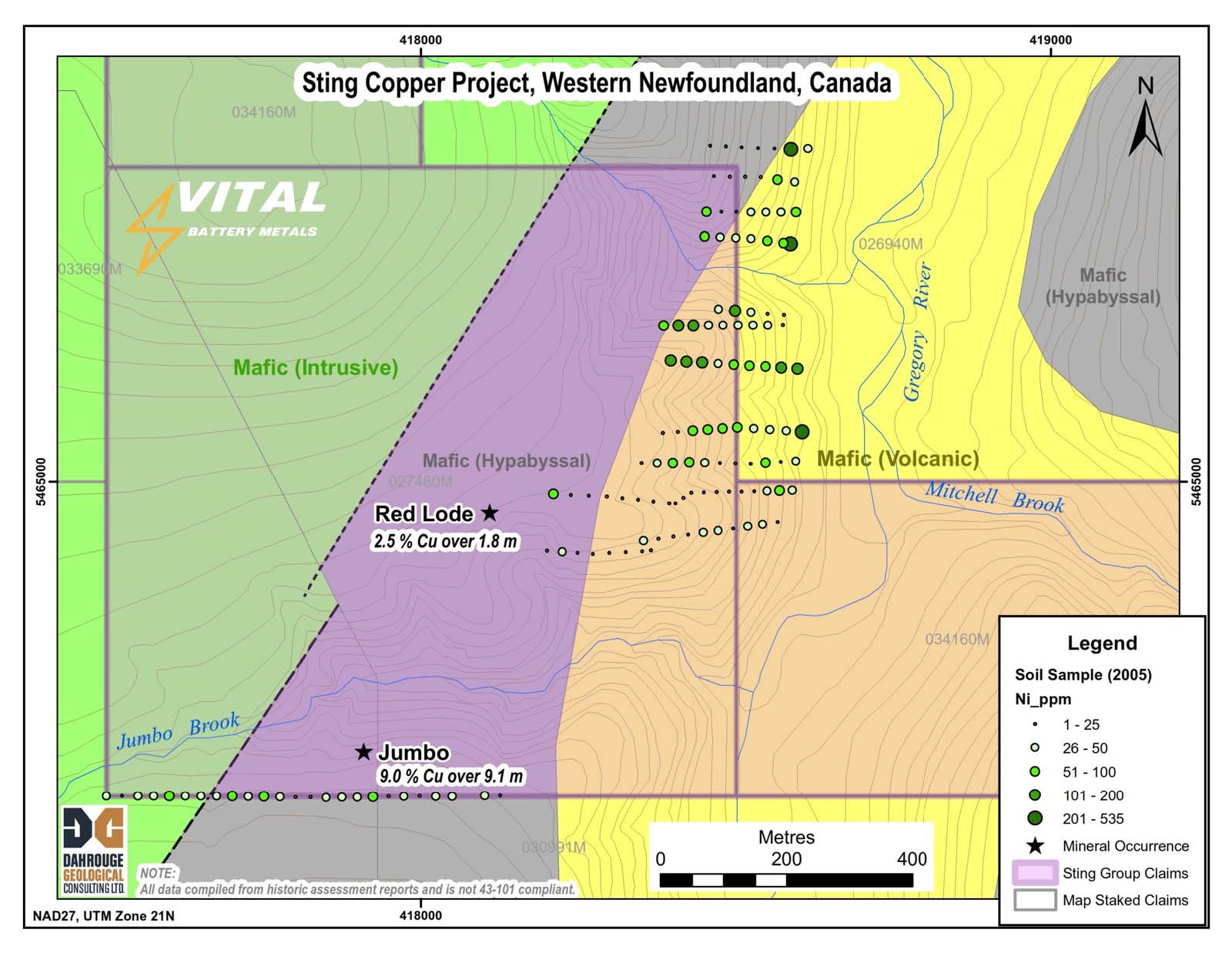
Elevated nickel occurs in soil samples in the Jumbo Lode / Red Lode area, typical of soil overlying mafic rocks.
Click image to enlarge.
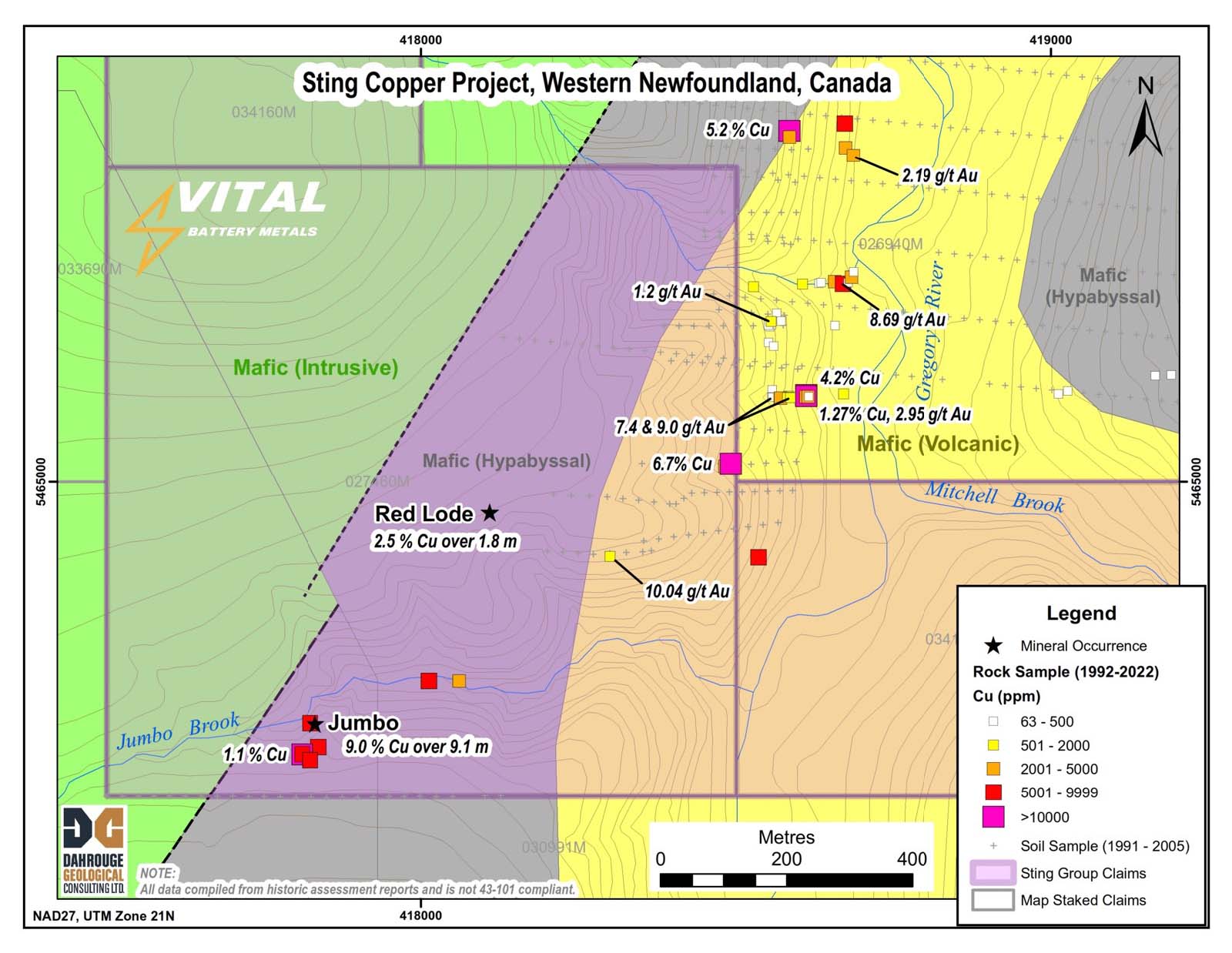
Rock samples collected by prospectors between 1992 and 2022 demonstrate the strong association of gold with copper mineralization in the Jumbo Lode area.
Click image to enlarge.
A survey described in a 2005 report highlights strongly anomalous gold in soil overlying mafic volcanic rocks near the contact with mafic intrusive rocks.